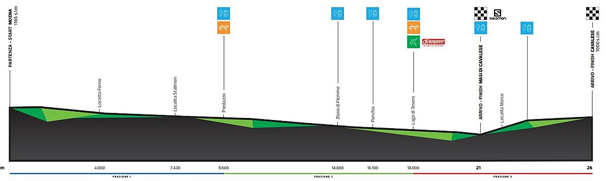
3D Map:
Thank you Wikiloc, official mapping partner

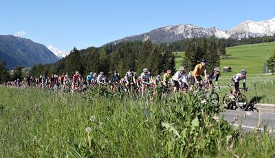
Percorso 21 km
- Altezza massima s.l.m. 1165 m
- Altezza minima s.l.m. 860 m
- Dislivello partenza-arrivo 305 mt.
Percorso 26,5 km
- Altezza massima s.l.m. 1165 m
- Altezza minima s.l.m. 860 m
- Massima diff. di altitudine 140 mt. (Masi di Cavalese - Cavalese)
- Tratto sterrato 1 Km
GPX
HM 21,097 km DOWNLOAD
26,5 km DOWNLOAD
LEG 1 Moena - Predazzo DOWNLOAD
LEG 2 Predazzo - Lago di Tesero DOWNLOAD
LEG 3 Lago di Tesero - Cavalese DOWNLOAD
Features 21 km
- Total Length:21,097 km
- Max Height a.s.l. 1165 m
- Min Height a.s.l. 860 m
- Heigth Diffence start/finish - 305 mt.
Features 26,5 km
- Total Length: 26Km
- Max Height a.s.l. 1165 m
- Min Height a.s.l. 860 m
- Heigth Diffence start/finish - 165 mt.
- Total Climb 160 mt.
- Altitude max difference 140 mt (from Masi up to Cavalese)
- Trail 1 Km
Description
- KM 0,000 - Start in Moena- town center
- KM 4,000 - Hotel Valsorda in Forno.
- KM 7,300 - Marcialonga headquarters in the ski jumping hill stadium.
- KM 9,600 - Predazzo Center. It continues along Via Fiamme Gialle and back on the cycling route
- KM 14,700 - Ziano di Fiemme, cycling route
- KM 18,000 - Lago di Tesero Cross-country ski stadium, cycling route
- KM 21,0975 - Masi di Cavalese Half Marathon
- KM 23 - Marco (suburb of Cavalese)
- km 26,5 - Cavalese Viale Mendini